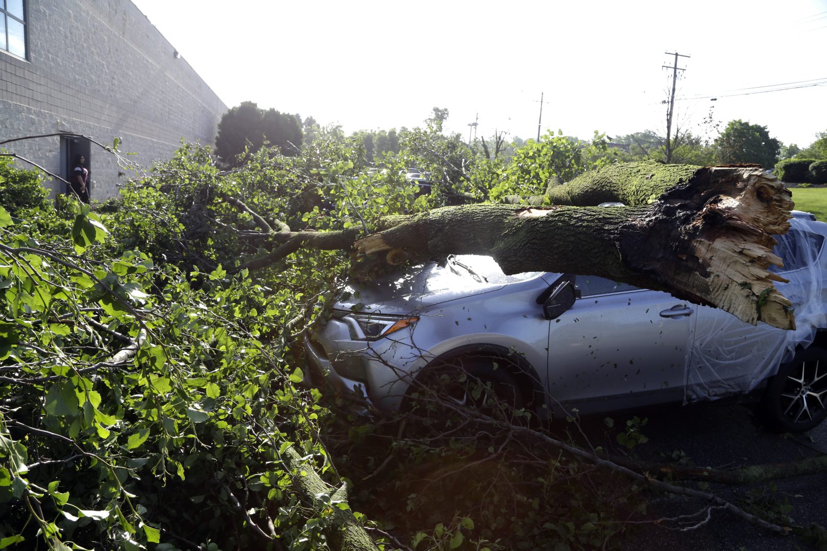
Downed tree limbs remain on cars outside a business Wednesday May 29, 2019 in Morgantown, Berks County. The National Weather Service says a tornado has been confirmed Tuesday in eastern Pennsylvania, where damage to some homes and businesses occurred, but there were no immediate reports of injuries.
Watchdog reporter covering politics, environmental issues and the "sin beat." Contact me at wmckelvey@pennlive.com or follow me on Twitter @wjmckelvey
Jacqueline Larma / The Associated Press
Downed tree limbs remain on cars outside a business Wednesday May 29, 2019 in Morgantown, Berks County. The National Weather Service says a tornado has been confirmed Tuesday in eastern Pennsylvania, where damage to some homes and businesses occurred, but there were no immediate reports of injuries.
(Harrisburg) — Predicting where tornadoes will form is a bit like making stovetop popcorn.
“You know those kernels are going to pop,” says AccuWeather senior meteorologist Dave Dombek, “but [you can’t] predict which one of those kernels on the frying pan is going to pop first.”
The last few weeks kept Dombek and his colleagues based outside State College particularly busy as one major thunderstorm after another—and the outbreak of tornadoes they birthed—swept across the Midwest toward Pennsylvania and on to the Northeast.
In a normal year, Pennsylvanians typically sees two or three tornadoes each May. As of Wednesday, eight were confirmed by the National Weather Service. To date, this year has seen 24 tornadoes, against the long-term state average of 17. On Thursday, the weather service confirmed two tornadoes struck central Pennsylvania this week: a tornado touched down in Perry County and another tornado struck Dauphin County.
Why has this year been so active?
First, it’s important to understand that tornadoes require a confluence of factors to form and they tend to follow a boom-bust cycle from one year to the next.
Dombek said tornadoes can crop up anywhere and at any time of the year but they are most common in late spring and early summer. That’s because they’re most likely to form when there’s a strong contrast between hot and cold—warmer ground and colder upper atmosphere—and powerful crosswinds found where hot and cold air masses collide.
“Up until about two weeks ago, the season was running about normal,” he said. “In the last two weeks it’s gone crazy . . . it’s gone absolutely berserk.”
The jet stream is a major factor in this rash of severe weather. This west-to-east current of air that encircles the globe typically moves in a fairly predictable manner but it dipped further south recently, forming deeper troughs and creating more pronounced weather contrasts.
In the west, Dombek said, it resulted in cooler than normal temperatures and a conveyer belt of storms heading across the Rocky Mountains toward the Midwest and Northeast. In the Southeast, it led to a heatwave in cities like Atlanta and Birmingham.
“What you’re seeing here is not unusual,” Dombek said. “What made it noteworthy is how persistent and stubborn that pattern has been.”
Once a thunderstorm has formed, he said, the last key ingredients for a tornado are a powerful updraft and a circular rotation.
“If you have the sheer and twisting of the winds in place, you have a potential to get some rotation,” he said.
In theory, climate change could be a factor in severe thunderstorms and the deadly tornadoes they spawn, since both feed off hot, humid weather.
Dombek said it’s possible that a warmer global temperature could lead to more frequent tornadoes but records haven’t been long enough to be conclusive.
Extreme weather, of course, happens regardless of global climate trends and it tends to be more noticeable in more populous areas with more property at risk.
Regardless of what’s causing the recent spate of extreme weather, Dombek said he takes his job seriously. The end goal, he said, is to keep people informed about what’s going on and hopefully save lives.
“You usually know ahead of time that there’s some potential but to say exactly where it will be . . . if it’s going to be in Linglestown and not over Halifax,” he said, “there’s no way you can tell where they will be until they happen.”